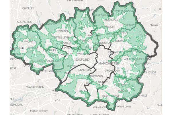
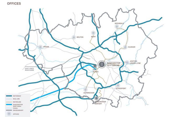
The UK project consisted of the various elements of GIS i.e. digitization, data scrapping, georeferencing, data searching and certain analysis in GIS software. The work was to obtain various data from the government website i.e. Boundaries – Greater Manchester Boundary and Local Authority Boundaries (10 District Boundaries), Transport – Road Network, Manchester Airport, Canal and Manchester Ship Canal, Urban Areas in Greater Manchester, Manchester City Centre, the Town Centres, and the Salford Quays, Proposed Green Belt, Site allocations etc.